
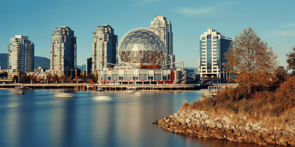
Vancouver’s Waterfront Defines Its Urban Identity
The meeting point between Vancouver and the Pacific Ocean shapes more than just the city’s map. This edge—where land stops and water begins—establishes a rhythm that influences architecture, movement, and atmosphere.
A person walking along the seawall at dawn experiences how the city leans toward the ocean. Buildings rise just beyond the edge, but their reflections rest in the water. The boundary feels fluid. Shorelines in Vancouver don’t divide—they connect, shaping how the city interacts with its environment.
Light Shifts Along the Shore Create Visual Drama
The ocean surface changes constantly. Tides, wind, and cloud cover alter the way light bounces off the water and nearby structures. These shifts affect how both locals and visitors see the city at different times of day.
At sunset, the western horizon becomes a mirror. Downtown buildings near Coal Harbour appear to float. Shadows grow longer and creep inland, stretching across plazas and sidewalks. These moments shift attention away from the skyline and toward the water’s edge, turning a public space into a temporary stage.
Coastal Movement Shapes Urban Activity
The shoreline controls how people move through Vancouver. Trails, walkways, and green spaces follow the water’s curve, creating a natural path for pedestrians, cyclists, and commuters. The flow of activity matches the tide—calm, continuous, and always adapting.
During peak hours, seawall routes carry hundreds of users. Office workers cut through shoreline parks on their way to transit stations. Photographers pause at lookout points near the harbor. This movement pattern, shaped by geography, reinforces the shoreline’s role as a vital part of urban function.
The Edge Creates Contrast Between Stillness and Motion
Where the city meets the Pacific, contrasts emerge. Tall buildings stand firm while water shifts. Concrete paths hold their shape, but shadows and reflections break them apart. These differences bring balance to the visual and emotional tone of the city.
Someone standing at the edge of a dock near Granville Island may notice how the city’s sharp lines begin to blur. The skyline reflects on moving water. Boats glide by while pedestrians remain still. In this contrast, the boundary becomes not a line, but a zone where differences interact.
Shoreline Architecture Responds to Water
Buildings near Vancouver’s coast are designed with the ocean in mind. Their shapes, materials, and orientations respond to moisture, wind, and shifting light. Architects plan for the marine atmosphere as a design factor, not an afterthought.
Along False Creek, residential towers use glass to catch ocean light. Their angles allow rooms to shift color as the sky changes. Public structures near the shore often include extended overhangs or open spaces that invite airflow and reflectivity. These choices create structures that belong to the edge, not just near it.
Tidal Rhythms Influence Public Perception
The Pacific tide does more than move water. It alters how people experience the shoreline. At low tide, beaches widen and surfaces appear. At high tide, boundaries shrink. This change builds a dynamic relationship between land and sea.
A commuter crossing the Burrard Bridge may not notice the tide directly, but its presence changes the view. It transforms the shoreline’s shape throughout the day. Urban memory connects to this rhythm, even when people don’t realize it. Tides become part of the visual and spatial vocabulary of the city.
Fog and Saltwater Air Shape Sensory Experience
The Pacific coast brings a sensory quality to the edge of Vancouver. Fog, salt in the air, and wind patterns influence how the city smells, sounds, and feels. These sensory details leave lasting impressions that shape local culture and daily routines.
A cyclist riding along Kitsilano Beach on a foggy morning may feel the air tighten and hear sounds differently. Traffic fades into the background. Seagulls and waves become the dominant soundtrack. These environmental shifts turn the shoreline into an immersive experience that changes hour by hour.
The Waterfront Hosts Shifting Light and Shadow
As the sun moves across the Pacific, it casts shadows that stretch across parks, buildings, and walkways. These shadows don’t just mark time—they create rhythm in the urban landscape.
At mid-afternoon, structures near the waterfront cast long shadows inland. Benches, trees, and sculpture silhouettes shift as light changes direction. Designers and city planners use this movement to define space. Sunlight creates corridors. Shadows make temporary shelters. Together, they shape how people engage with shoreline areas throughout the day.
Ocean Views Anchor Community Identity
For many in Vancouver, the ability to see the ocean daily becomes more than a visual benefit—it’s part of their sense of place. Views of the Pacific define neighborhoods, affect property values, and contribute to emotional well-being.
A resident in the West End may describe their location not just by street, but by direction—“facing the water” or “by the inlet.” These references become part of local language. The ocean isn’t a backdrop. It’s a landmark, a measure, and a companion in urban life.
Public Access to Shorelines Reinforces Equity
The city’s approach to shoreline access plays a key role in shaping community experience. By preserving public paths, parks, and open waterfront spaces, Vancouver keeps its edge open to everyone.
Someone working downtown can walk to the water during a break, sit along the seawall, and return to the office within minutes. That access isn’t random—it’s a design principle. Keeping the Pacific visible and reachable ensures the city’s connection to the water remains shared, not exclusive.